Survey Services

Survey Drawings for Hellenic Cadastre and Permits
Precise survey drawings are essential for the Hellenic Cadastre and permit applications. GNSS receivers and total stations ensure accurate documentation of land parcel measurements and boundaries, adhering to national standards. These detailed surveys facilitate property registration and permit approval for any land type.

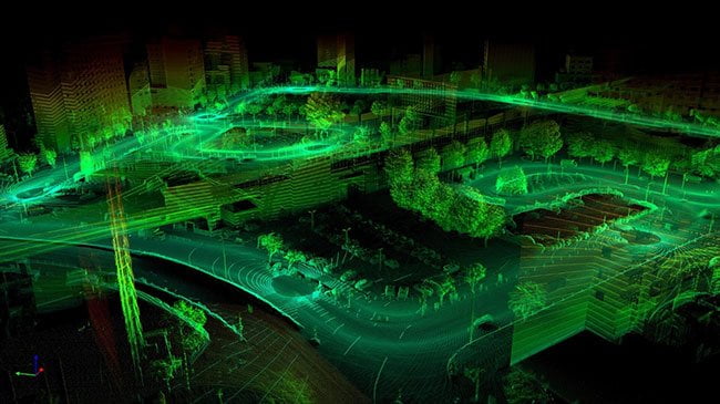
Mapping of Large Areas for Wind Farms and Solar Parks
Specializing in large-scale area mapping, essential for developing wind farms and solar parks, high-resolution topographic maps and 3D models are created with state-of-the-art drones with LiDAR sensors. This detailed data aid in site selection, planning, and optimizing layouts for maximum energy efficiency, laying a solid foundation for sustainable renewable energy projects.
Construction Monitoring
Construction projects benefit from comprehensive monitoring services provided through high-precision instruments, delivering data that help verify structural integrity, ensure compliance with design specifications, and identify potential issues early. Timely and precise reports help maintain project timelines, control budgets, and ensure adherence to quality and safety standards.
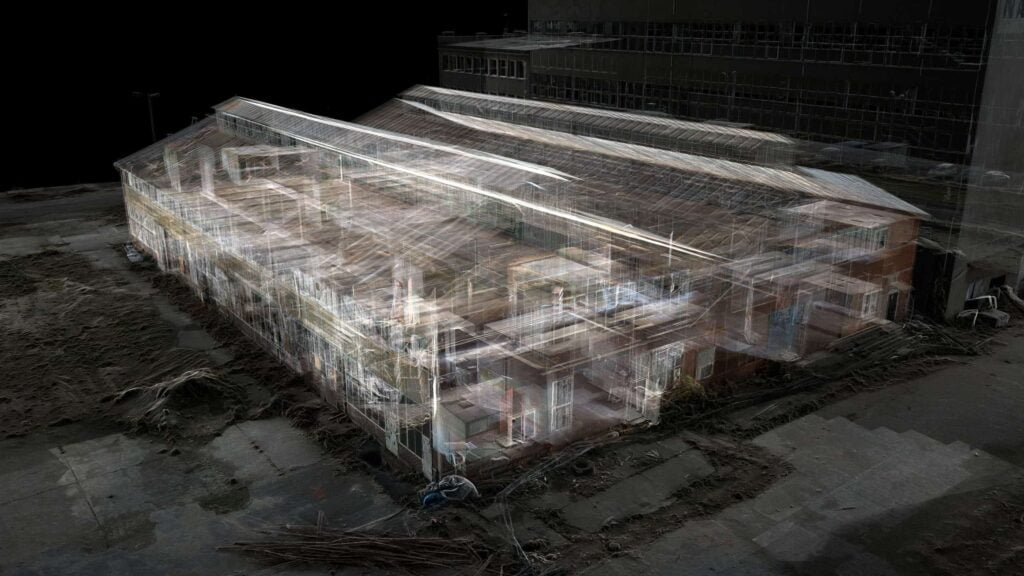
As-Built Drawings for Buildings
As-built drawings, reflecting the final condition of building projects with precision, are crucial for future renovations, facility management, and legal compliance. Advanced 3D laser scanning technology ensures detailed and accurate as-built documentation, providing a reliable record of the existing structure.

Support in Construction Sites
Thorough support services for construction sites facilitate smooth project execution from start to finish. On-site surveys, stakeouts, and layout services are provided using GNSS receivers and total stations. This ensures precise positioning of structures, utilities and infrastructure, adhering to design plans and regulatory requirements.
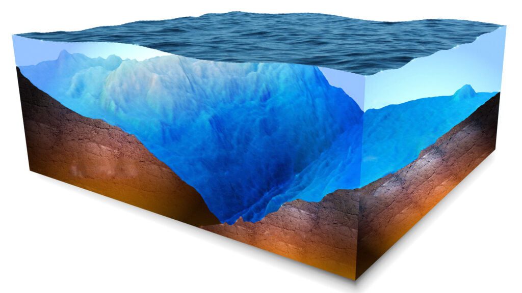
Bathymetry
Bathymetric surveying offers accurate maps of underwater terrains using sonar technology and GNSS receivers. This information is vital for marine construction, dredging, and environmental monitoring, supporting safe and efficient operations and informed decision-making.